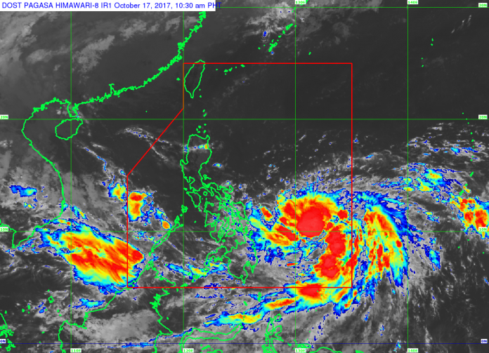
Tropical Storm “Paolo” has strengthened into a severe tropical storm as it continues to move over the Philippine Sea, the state weather bureau reported on Tuesday, October 17.
In its 11:00 am weather bulletin, PAGASA said Paolo was last sighted at 765 kilometers East of Guiuan, Eastern Samar. It has a maximum sustained winds of 90 kilometers per hour and gustiness of up to 115 kilometers per hour.
The severe tropical storm is moving north northwest at 7 kilometers per hour. Based on its forecast track, the weather disturbance will not make landfall in the Philippines and will not directly affect the country.
The estimated rainfall amount is from moderate to heavy within the 450-kilometer diameter of the severe tropical storm and its outer rain bands may bring scattered light to moderate with possible occasional heavy rains over Bicol Region, Visayas and Mindanao, the state weather bureau said.
PAGASA added that Paolo may also intensify into a typhoon before exiting the Philippine Area of Responsibility on Sunday morning.
Meanwhile, the low pressure area (LPA) located at 395 kilometers West of Coron, Palawan, and embedded within the Intertropical Convergence Zone will continue to bring scattered light to moderate with possible occasional heavy rains over Visayas, Mindanao, Bicol Region, and Palawan. —R4A/DOST-PAGASA


